National Parks
Yosemite National Park - Half Dome - June 16-18, 2006
Yosemite National Park - Half Dome - June 16-18, 2006
On June 17 a group of us from Monterey set out to hike to the top of
Half Dome. After a nights rest in Curry Village, we set out on the
trail at ~6:30a. We had hoped, by starting so early, that we'd start
ahead of the main waves of hikers, but I think everyone else had the
same idea as us -- it was a virtual highway all the way to the top. We
chose to start from the valley floor at Happy
Isles, skirt alongside and across Vernal Falls and Nevada Falls up the
Mist Trail to the John Muir Trail intersection.
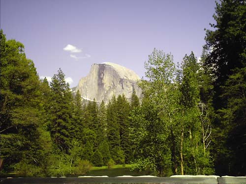
The classic view of Half Dome from the valley. The black streak down
the sheer face is from the last bit of snow that stays through a good
bit of the summer.
The east "shoulder" of Half Dome, partially visibile in this photograph
(left portion of Half Dome),
is the side that you scale with the cable ladder.
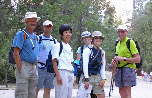
The group! Pete, Mike, Eiko, Theresa, me, and Robin.
Ann took
the picture.
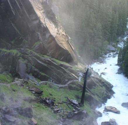
This is Mist Trail, just at the base of Vernal Falls. I think the trail
is aptly named; however, in June after a wet winter, I think Deluge
Trail is more fitting! We all got very wet. This may well have been my
most favorite part of the hike. It felt very surreal. It was wet, like
a rain forest, but very chilly. And I wasn't in a rain forest, I was at
Yosemite with a super large waterfall thundering down just a few meters
away. It really was spectacular.
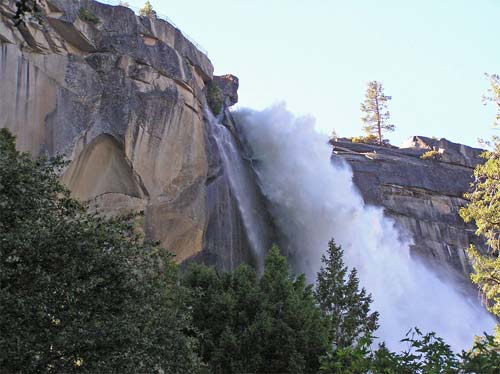
Upstream of Vernal Falls is Nevada Falls. The trail takes you very near
to Nevada Falls (though not close enough for "mist"). Again, being so
close to the power and force of a large waterfall is amazing.
The junction with John Muir Trail is just at the top of the falls.
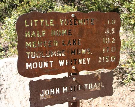
The junction! This is just about the halfway point.
We decided that Mt. Whitney was a little bit out of our range for a day
hike!
The hike to, and through, Little Yosemite Valley is lovely. Its quite flat and a little bit sandy -- a nice respite between the major uphill portions of the hike.
The hike to, and through, Little Yosemite Valley is lovely. Its quite flat and a little bit sandy -- a nice respite between the major uphill portions of the hike.
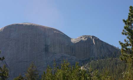
This is the view of the back side of Half Dome from Little Yosemite
Valley. The saddle is where the cable ladders begin.
Though the
perspective and scale of the picture may not show all the details, the
cable ladder section is .25 mile long and you gain 600' -- that's an
average slope of 48°!
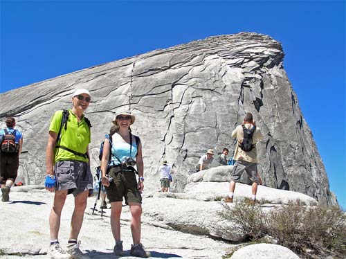
Theresa and Robin are almost there!
You can see the cable ladder just behind Theresa's head!
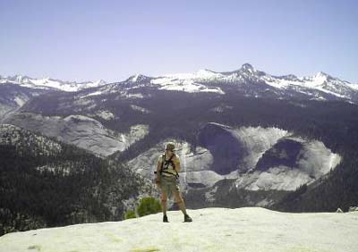
Me, pooped out from the steep switchbacks that precede the saddle and
cable ladder.
The "back drop" for this picture is spectacular!!
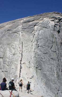
The cable ladder! From this perspective, it looks way steeper than
48°. And when you're on it, again, you'd swear its steeper.
It was generally slow goin' on the ladder. Understandably, a lot of people get quite apprehensive mid-way up and really slow down the progress of those coming up from behind. This is fine, though, as long as you're patient. What frustrated me most was those impatient, selfish folks that would push past the nervous ones, only making their state worse. The other bottleneck is sharing and negotiating the cables with those passing in the opposite direction.
It was generally slow goin' on the ladder. Understandably, a lot of people get quite apprehensive mid-way up and really slow down the progress of those coming up from behind. This is fine, though, as long as you're patient. What frustrated me most was those impatient, selfish folks that would push past the nervous ones, only making their state worse. The other bottleneck is sharing and negotiating the cables with those passing in the opposite direction.
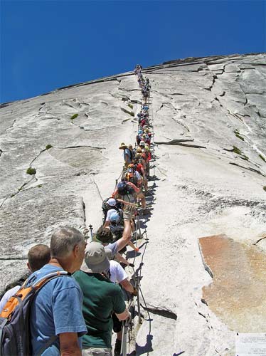
Pete waiting his turn!
I had gone up a bit earlier than this and thought what I had battled
through was crowded. Holy Cow!
It was even more crowded once we made our way down!
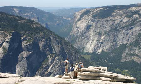
Our group at the top, overlooking Yosemite Valley.
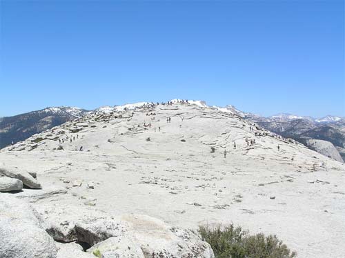
The top of Half Dome. The best way to describe it is "Martian". Not to
mention its HUGE -- 5 acres!
Backpackers used to be allowed to camp up here but the park has
disallowed that these days in an effort to protect a rare salamander
habitat as well as any remaining plant life (which is next to none).
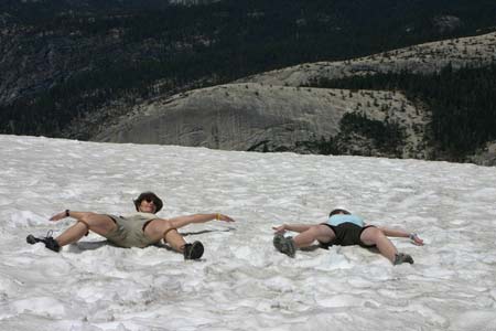
Theresa and I couldn't resist the temptation of making snow angels in
the remaining patch of snow at the top! Brrrrrrr!
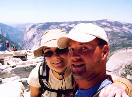
Mike and I made it!
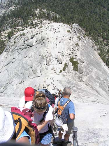
Pete heading down.
Quite an angle and perspective. Again, when you're on it, it sure seems a lot steeper! Given the crowds, we found it easiest to head down on the outside of the cables -- it was easier to negotiate all the people coming up.
Quite an angle and perspective. Again, when you're on it, it sure seems a lot steeper! Given the crowds, we found it easiest to head down on the outside of the cables -- it was easier to negotiate all the people coming up.
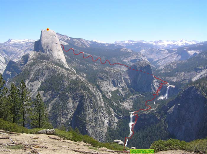
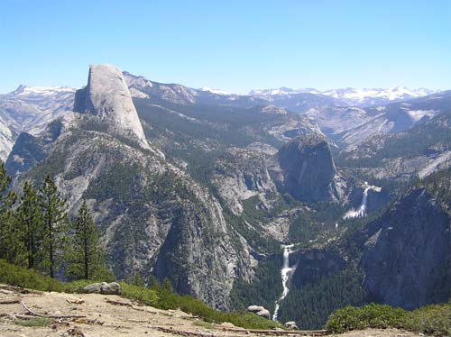
This is the whole hike mapped out (as viewed from Washburn Point). As noted earlier, we started our hike at Curry Village,
skirted up along side Vernal and Nevada Falls, joined up with the John Muir Trail and then branched off onto Half Dome Trail
for the final 2 miles.
We retraced our steps on the way back, until the junction of John Muir Trail w/ Mist Trail. We stayed on John Muir Trail back
to vernal Falls. Vernal Falls to Curry Village was retraced as well.
In all, it was a 12 hour day -- we spent over 90 minutes at the top. Our roundtrip hiking distance was on the order of 19 miles.
In all, it was a 12 hour day -- we spent over 90 minutes at the top. Our roundtrip hiking distance was on the order of 19 miles.
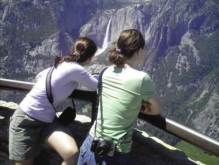
The next day we headed up to Glacier Point for a different vantage point of our hike and of the rest of the valley.
Can you tell which one is me and which one is Theresa!?
Can you tell which one is me and which one is Theresa!?
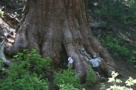
On our way out of the park (had to use hwy 41 because of the rock slide closure of hwy 140) we stopped by Mariposa Grove of
Giant Sequoias for another glance at these monsters!!
