50 High Points
Utah - King's Peak (13,523') - August 12, 2012
Utah - King's Peak (13,523') - August 12, 2012
Kings Peak 11-13 August, 2012
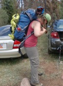
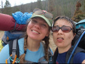
I needed a getaway this summer so I enlisted the help of my friend Stacie who lives near Park City, UT. I had not yet gotten the UT highpoint simply because the length of the trek requires backpacking (for sane people) and I loathe backpacking. I pitched the idea in June and she was on board. We decided August was the best time given our schedules and the climate for the area.
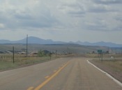
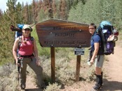
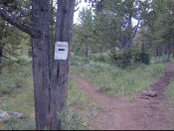
I flew into SLC on Thursday, August 9th. We spent Thursday and Friday up near Park City prepping for our trip and simply visiting - it had been nearly 2 years since we had last seen each other. Saturday morning we left Park City around 9a to head toward Mountain View, WY, the last town before entering the Uintas Wilderness and reaching the trailhead. After a quick potty stop in Mountain View we arrived at the trailhead in just under 3 hours. We had borrowed Tim's gazetteer and it proved far more useful than any of the highpointing guidebooks did in navigating our way to the trailhead. We used a rental car, a Dodge Avenger, and it handled the USFS roads just fine. As far as forest service roads go, these roads were like a highway - super wide and very well maintained. There is no need for a high clearance all-terrain vehicle to get to the trailhead.
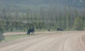
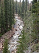
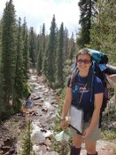
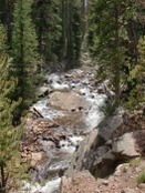
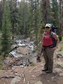
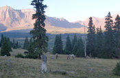
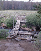
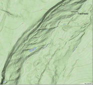
We hit the trail around 12:40 Saturday afternoon. The hike was quite pleasant next to and above Henry's Fork. The trail is multi-use and there was indeed a lot of bridle activity. We always made sure to give the horses plenty of clearance. We stopped along the way in a few places for pictures and snacks and potty breaks. Overall, I was doing just fine with the elevation - my two nights at 7,000' near Park City certainly helped.
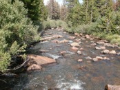
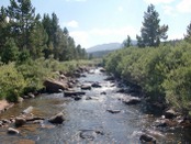
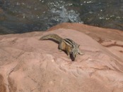
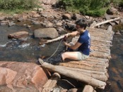
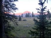
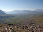
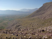
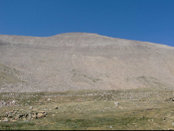
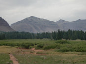
After about three hours of trekking we hit the crossing for Henry's Fork (~6 miles from the trailhead). We stopped to pump water and grab another snack. We spent the better part of an hour here. It was so beautiful - bright blue skies, a babbling brook, and crazy chipmunk entertainment! As we were packing up to gain the trail again we ran into a USFS ranger. We chatted a bit and then he guided us out into the adjacent meadow so we could fix our first clear glance upon Kings Peak. It still looked so far away!
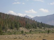
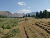
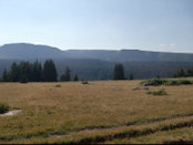
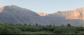
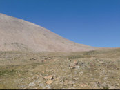
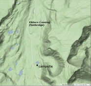
After you cross the footbridge you head up a tree-covered slope before entering into the eternal meadow. This climb is where I was really finally starting to feel the altitude. We pressed on and all through the never-ending meadow Kings Peak never appeared to get any closer. While that meadow is pretty it is frustrating because its openness makes your progress much less apparent.
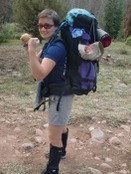
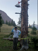
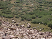
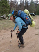
You cannot see Dollar Lake from the trail, but we figured its rough whereabouts and scoped out our camp by about 5:40p or so. We set up our camp in a gathering of pine trees about 100 yards East of the trail and < 0.25 miles South of the lake at ~ 10,800. elevation. The hike for day one was ~8 miles. We did all the normal evening campsite tasks and were cozied up in our bags well before the sun went down. I am such a grandma and thankfully Stacie humored those tendencies. Sleeping that night was difficult - I was anxious for summit day plus my body was not happy with me. Every time I rolled over trying to get comfortable my head pounded and my lungs heaved for more oxygen.
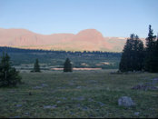
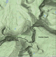
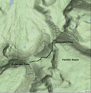
We woke up Sunday morning at 6:00a and we hit the trail by 7:00a. Where we camped under the pine trees was nice and cozy but out in the meadow frost had blanketed the grass. The sun was rising beautifully giving way to a bright clear blue sky. It was going to be a good day for summit! We pushed hard to Gunsight Pass (~2.5 miles from camp). We saw a party taking off for the short-cut and it looked daunting craning up at it. We didn't want to drop all the way into Painter Basin so we took a hybrid approach. Despite trying to find the middle ground we ended up intersecting with the Painter Basin trail and trudged our way up toward Anderson Pass.
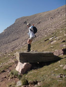
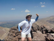
The push from Anderson Pass to summit is not quite as advertised. All of the guidebooks I referenced indicate this hike is class 2 or class 2+ or class 2 strenuous. There are no bones about it, the last mile and 1000 vertical feet are class 3. I don't have a problem with class 3 - I find it a fun challenge. However, I know that is not the case for everyone, so heed caution if you are not comfortable on class 3 terrain. The class 3 is unrelenting from Anderson Pass to summit. Also note, there is no longer a "trail". There are many cairns placed alongside boulders that you can try to use to navigate but at this point your general direction is apparent - UP!
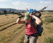
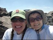
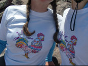
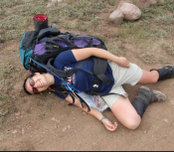
Stacie and I pressed on together until about 13,200'. Even though she was so close the elevation was taking a toll on her and she was not interested in pressing on any further. The "trail" was heavily traveled at this point so we agreed to separate so I could chase down my 33rd highpoint. I made the summit at 12:30p. I hung around long enough to take in the view, take a few requisite photos, and hunt for a USGS benchmark to no avail. I did not want to tarry since I had left Stacie half-way up the ridgeline. While on the summit, however, I had gained some information from other parties about the short-cut to return to camp.
When I met back up with Stacie she was feeling much better. I told her about the short-cut. Since we were both out of water we decided it would be best to take the short-cut back to camp. [Note however, that if you bring your water filter/pump with you on your summit trek, there is a good source of fresh water in the high altitude meadow just at the base of the summit. We would have pumped here had we brought our filters.] We caught up with a group of boy scouts and their leaders so we used them as our guides through the short-cut. The short-cut saved us a lot of time and distance. It was well worth using for the descent back into camp. Be aware, however, that the short-cut is solid class 3 and even class 4 in a few places. It is very steep and the footing can be precarious in places. I am not sure how much fun it would be to use the short-cut on the way to the summit.
We got back into camp around 4:30p. We were both too spent to even dream of breaking camp and packing out that day. Fortunately we had built a third day into our plans as a buffer - we needed it. We munched down some food, drank a bunch of water, and reflected on the day. Clouds were rolling in and we were thankful we had such a great summit day. Just as we had done the previous evening, we were in our sleeping bags before darkness fell.
The next morning we slept through my alarm, but we still got a good start. We broke camp, repacked our packs (fortunately a little lighter on the way out), and hit the trail by 7:00a. The trek back through the never-ending meadow still seemed long on the way out. One last glance at Kings Peak showed it was shrouded in clouds - what a difference a day makes! The hike back to the trailhead went quickly, although the age-old phrase of "are we there yet?" constantly danced through our heads. By 10:30a we were back at the car. We were tired but we were excited to be getting back to civilization.
All in all we fared quite well. The only injuries each of us suffered were blisters. All told we spent 46.5 hours in the wilderness and hiked 27ish miles. To me, Kings Peak ranks as one of my hardest highpoints. The hiking wasn't difficult, but I hate backpacking and that certainly took its toll on me. Nevertheless, #33 is in the bag!